


Naypyidaw: Myanmar experienced a 4.7-magnitude earthquake on Thursday, according to the National Center for Seismology (NCS). The tremor occurred at a depth of 120 km.
In a post on X, the NCS reported: “EQ of M: 4.7, On: 04/09/2025 11:03:35 IST, Lat: 23.97 N, Long: 94.50 E, Depth: 120 Km, Location: Myanmar.”
Earlier the same day, the region was hit by another earthquake measuring 4.1 in magnitude at a depth of 70 km. The NCS stated: “EQ of M: 4.1, On: 04/09/2025 09:52:06 IST, Lat: 21.88 N, Long: 96.08 E, Depth: 70 Km, Location: Myanmar.”
On Wednesday, a 3.7-magnitude earthquake struck Myanmar at a shallow depth of 10 km, raising the likelihood of aftershocks. According to the NCS: “EQ of M: 3.7, On: 03/09/2025 16:23:40 IST, Lat: 23.85 N, Long: 93.73 E, Depth: 10 Km, Location: Myanmar.”
Shallow earthquakes are generally more hazardous than deeper ones because their seismic waves travel a shorter distance to the surface, causing stronger ground shaking and potentially more structural damage and casualties.
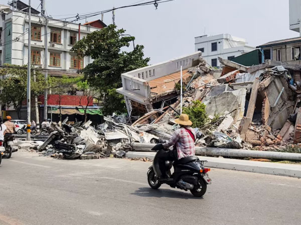
Following the magnitude 7.7 and 6.4 earthquakes that struck central Myanmar on March 28, the World Health Organization (WHO) warned of escalating health risks for tens of thousands of displaced residents, including tuberculosis (TB), HIV, and vector- and water-borne diseases.
Myanmar is prone to moderate and large earthquakes, as well as tsunami hazards along its extensive coastline. The country sits at the intersection of four tectonic plates—the Indian, Eurasian, Sunda, and Burma plates—making it geologically active.
A 1,400-kilometre transform fault runs through Myanmar, connecting the Andaman spreading center to a northern collision zone known as the Sagaing Fault. This fault heightens the seismic risk for Sagaing, Mandalay, Bago, and Yangon, which together account for 46% of Myanmar’s population. While Yangon is relatively distant from the fault, its dense population still makes it vulnerable. For example, in 1903, a 7.0-magnitude earthquake in Bago also caused significant effects in Yangon.